


GL / rund um den mürtschenstock

denisewanderige
User
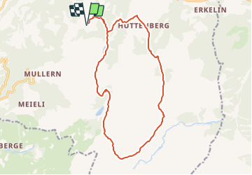

Length
17.1 km

Max alt
1846 m

Uphill gradient
1175 m
Km-Effort
33 km

Min alt
987 m

Downhill gradient
1175 m
Boucle
Yes
Creation date :
2014-12-11 00:00:00.0
Updated on :
2014-12-11 00:00:00.0
--
Difficulty : Unknown

FREE GPS app for hiking
 SityTrail
IGN / Geographical institutes
SityTrail Plus
The world is yours!
About
Trail Other activity of 17.1 km to be discovered at Glarus, Unknown, Glarus Nord. This trail is proposed by denisewanderige.
Description
Details (Wanderbeschrieb, Fotos, Dauer, Links, usw.) siehe unter:
http://www.wanderige.ch/wanderige_toure/2006/muertschen/muertschen.htm
Positioning
Country:
Switzerland
Region :
Glarus
Department/Province :
Unknown
Municipality :
Glarus Nord
Location:
Unknown
Start:(Dec)
Start:(UTM)
509454 ; 5216709 (32T) N.
Comments